


Tuesday stays all dry with sunshine in the morning and clouds in the afternoon. Wednesday morning is still dry and mostly cloudy but the snow showers arrive Wednesday afternoon and evening.
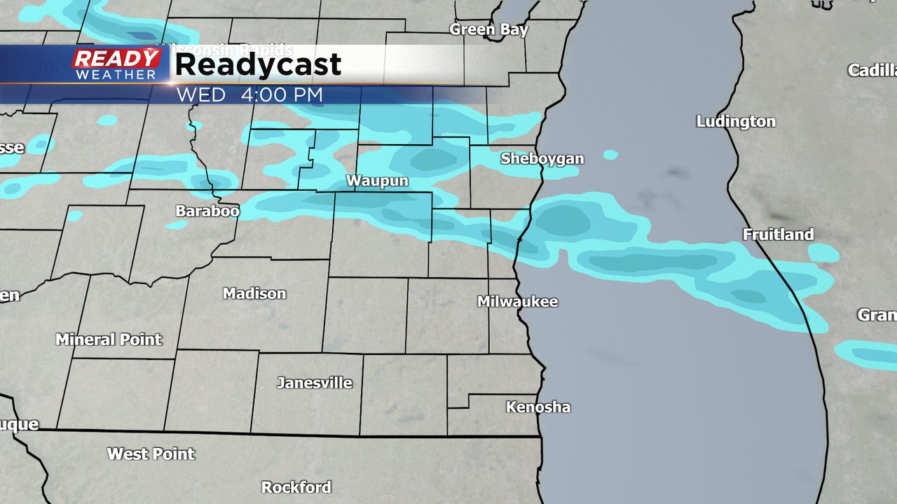
By the late evening hours the snow switches over to freezing rain and sleet. That wintry mix could last through early Thursday morning but should be done by the heart of the Thursday morning commute. Northern counties likely stay all snow and don't see much mix at all.

Snow totals won't be too impressive with around an inch in northern counties where they don't see any mix then up to an inch for the rest of southeast Wisconsin.

Any ice will make an impact and at least a glaze of ice is possible for parts of southeast Wisconsin with higher totals towards the Illinois border where a few hundredths of an inch up to a tenth of an inch will be possible. A winter weather advisory for ice is possible.
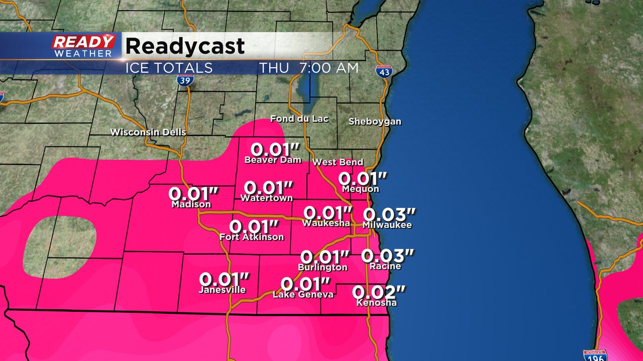
This will be one of those storms where you want to wait to shovel the snow until after the ice is done when you get up Thursday morning or else you will have to deal with even more slippery driveways and sidewalks. Temperatures Thursday will warm fast into the upper 30s so any ice that does fall will melt quickly.
Download the CBS 58 Ready Weather app to track the snow to ice.