Late Evening Update: Flash Flood Warning issued for Racine until 12:30 am


Updated: Sunday, September 11th 10:40pm:
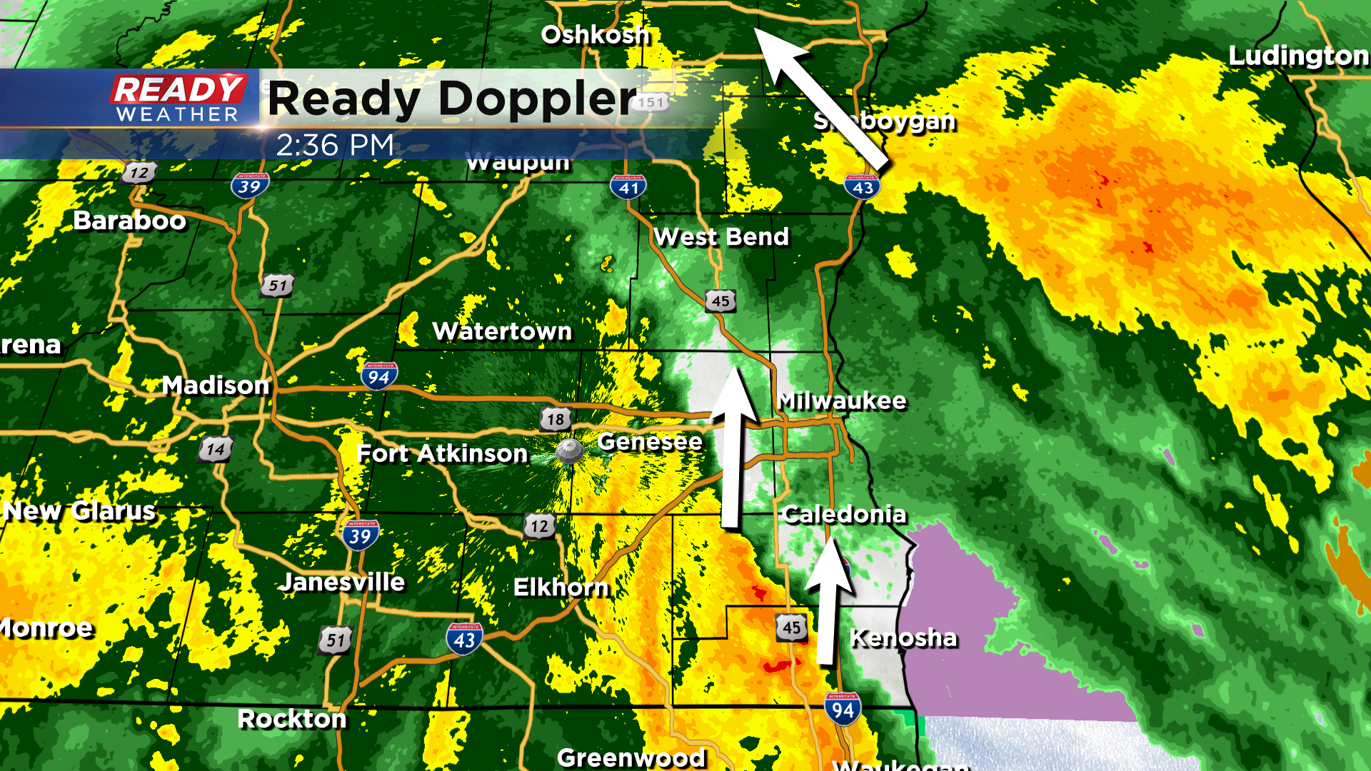
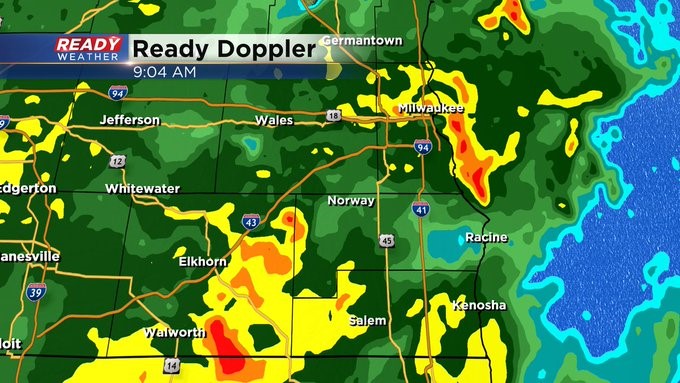
A Flash Flood Warning has been issued for Racine until 12:30am. A nearly stationary band of rain with 1 inch per hour rainfall rates is sitting over the area that has already seen 4.50"-7.50" of rain today.
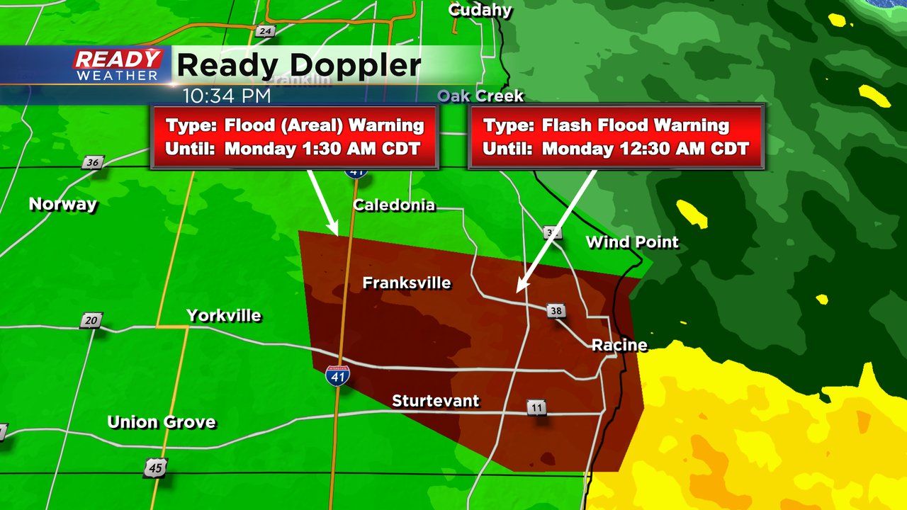
Given how persistent the rain has been, the larger Areal Flood Warning has been extended until 3am.
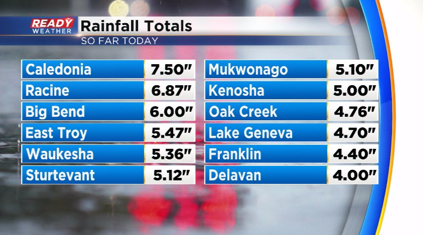
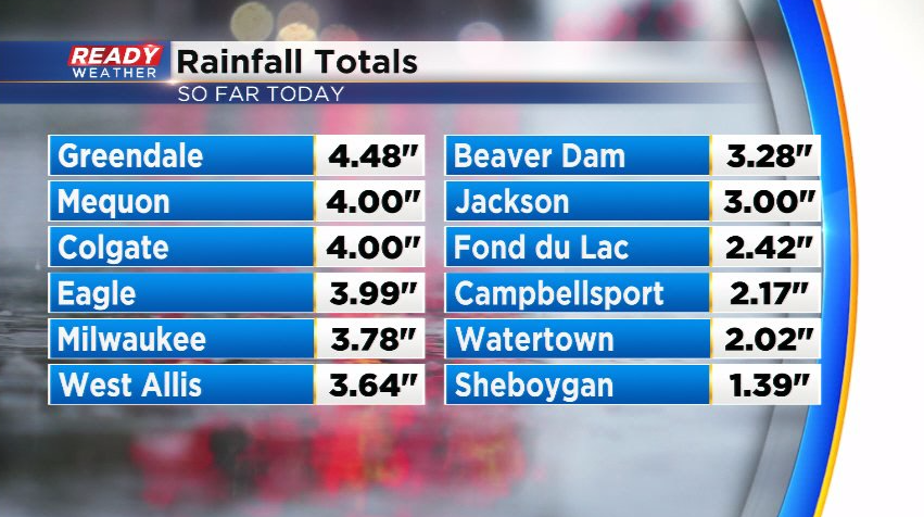
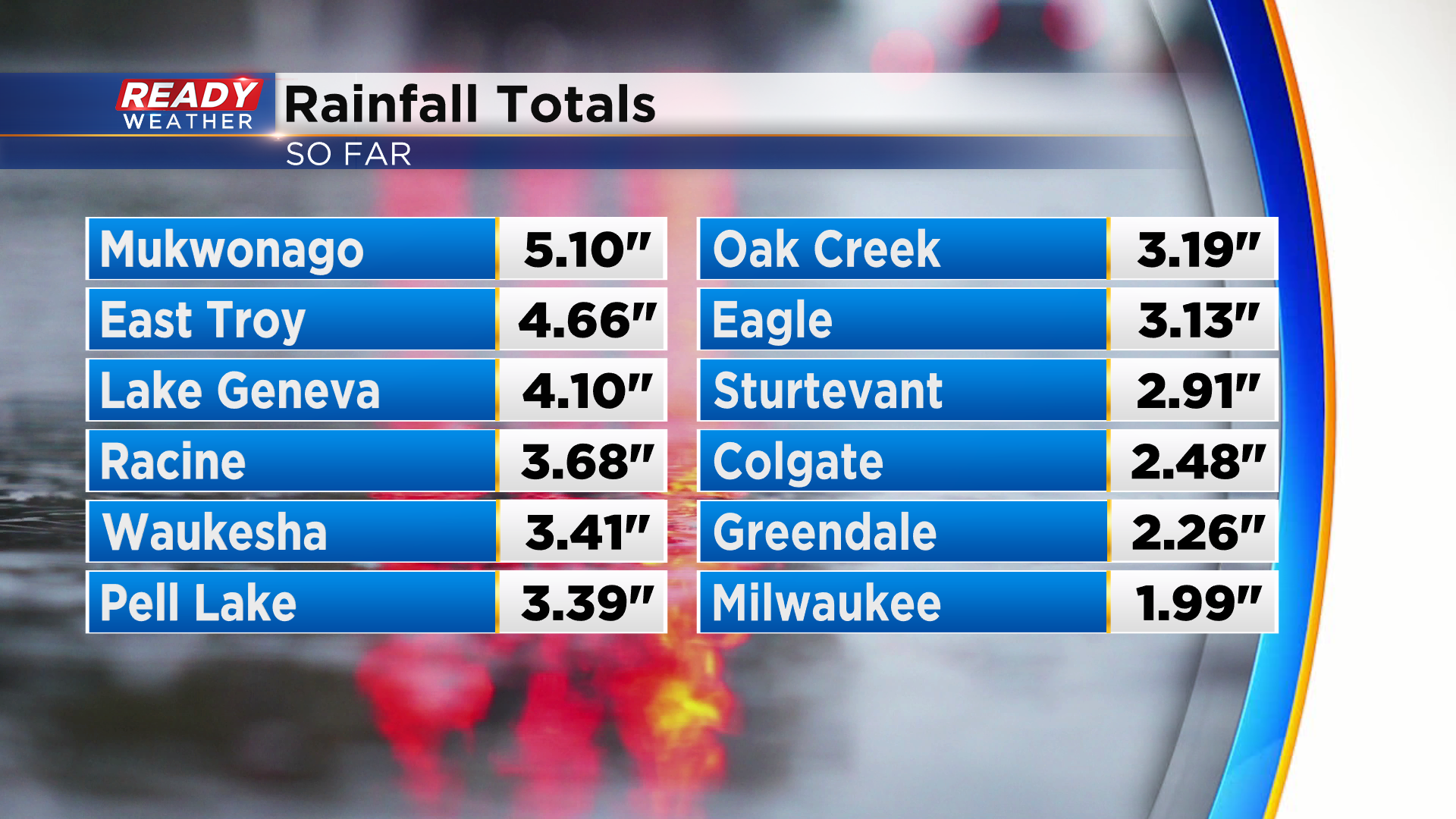
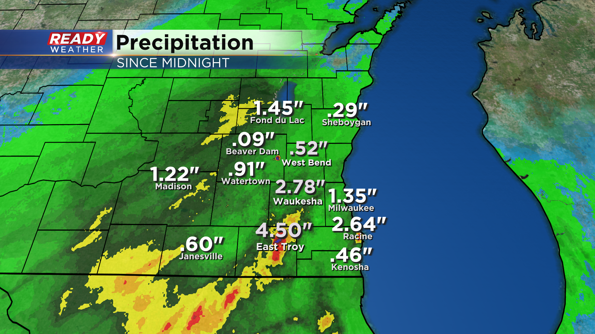
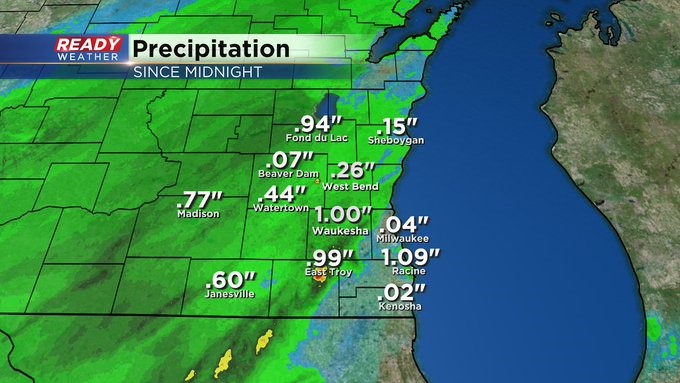
Steadier rain looks to taper off to spotty showers after 2-3am. Here are a bunch of rain totals through 10:30pm as well:
------------------------------------------------------------------------
Updated: Sunday, September 11th 7:30pm:
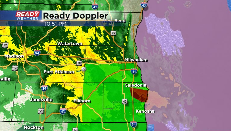
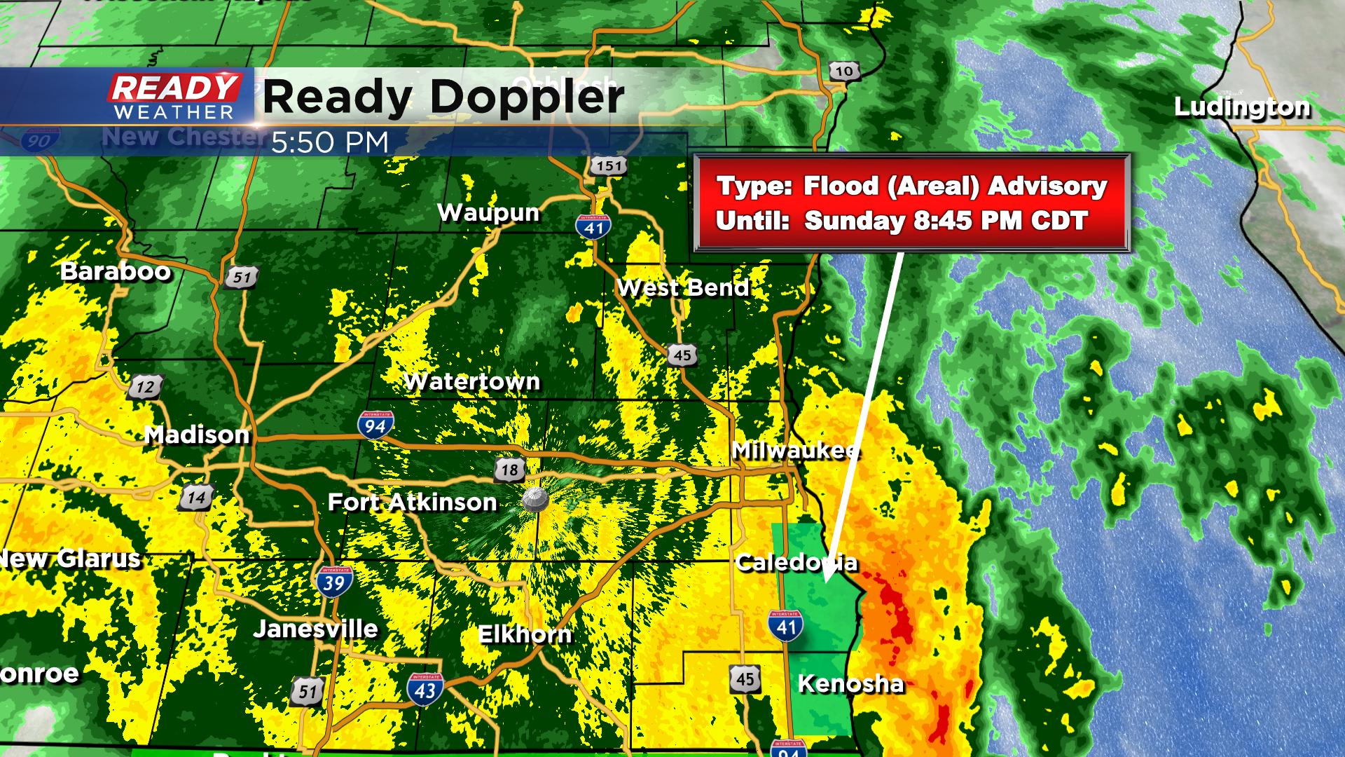
An Areal Flood Warning has been issued for all of Racine and Kenosha counties, southern Milwaukee and Waukesha counties, and eastern Walworth county until 1:30am. Standing water is being reporting on roads across Racine county, and more flooding is likely as the rain continues to fall.
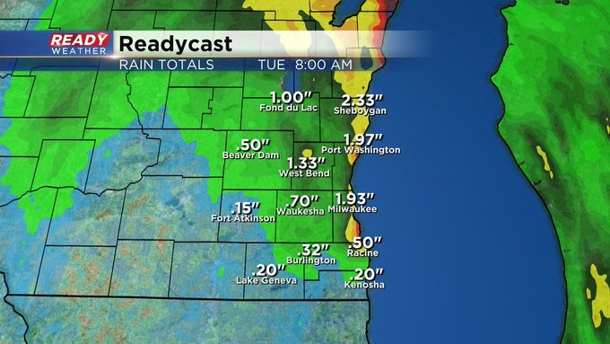
As of 7:45pm, this area has picked up between 2.50"-5.50" of rain over the last 12 hours and counting. Use extreme caution while driving through these areas tonight.
---------------------------------------------------------------
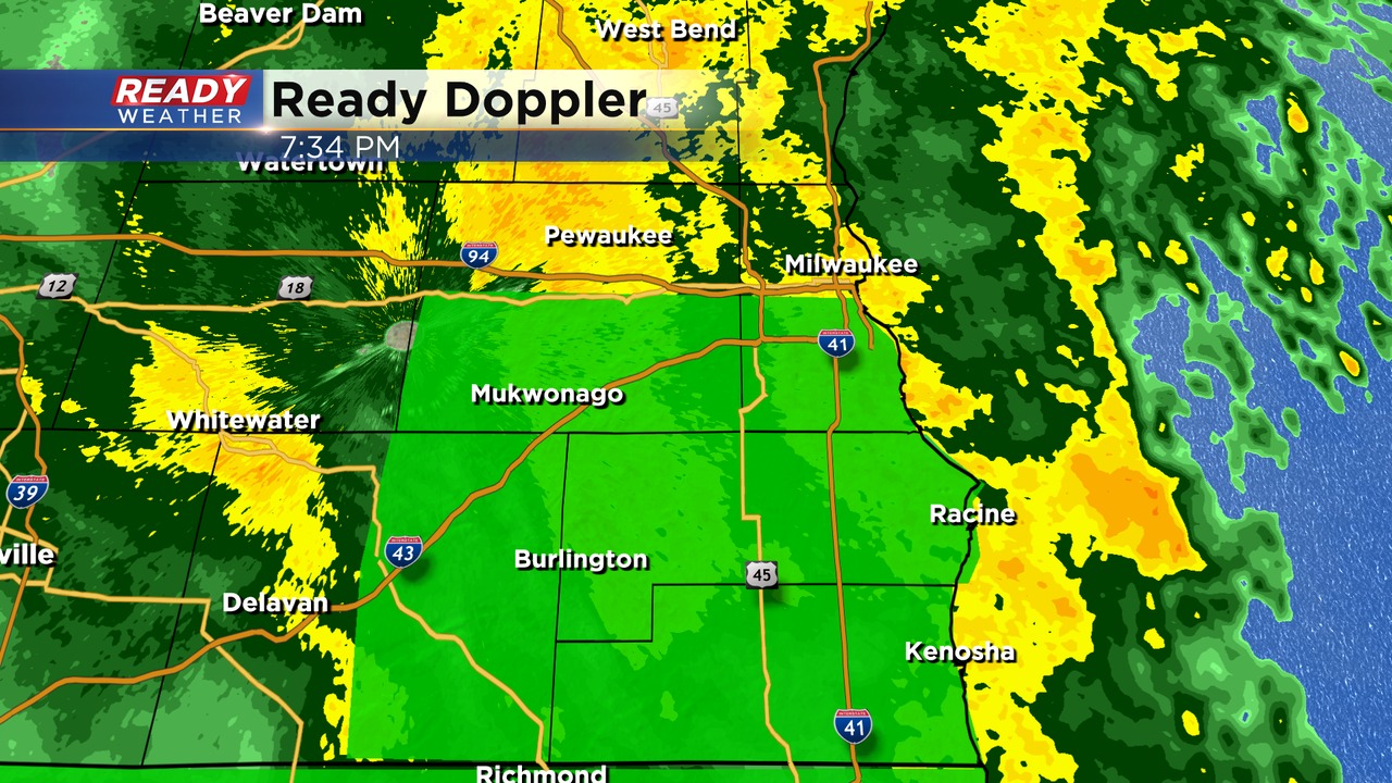
Updated: Sunday, September 11th 5:30pm:
Steady moderate to heavy rain continues to fall across southeast Wisconsin and has been fairly relentless for the last couple of hours in Racine, Kenosha, Walworth, and southern Milwaukee county. An Areal Flood Advisory has been issued for parts of Racine, MKE, and Kenosha counties through 8:45pm for low lying flooding.
A large portion of the area has picked up 2-5" of rain through 5pm, especially areas along and south of I-94.
An additional 1-3" of rain will be possible through tonight before the heavy rain pushes to our north and west.
---------------------------------------------------------------------------------
Updated: Sunday, September 11th 2:30pm:
There has been some impressive rain totals in southeast Wisconsin through 2pm with some spots already between the 2.50-4.50" mark!
After some lighter rain around midday, moderate to heavy rain is lifting north out of Illinois and will produce 1-2" per hour rainfall rates and it slowly rotates through SE WI.
The area of moderate to heavy rain will continue to expand across more of SE WI through the evening with an additional 1-4" of rain possible.
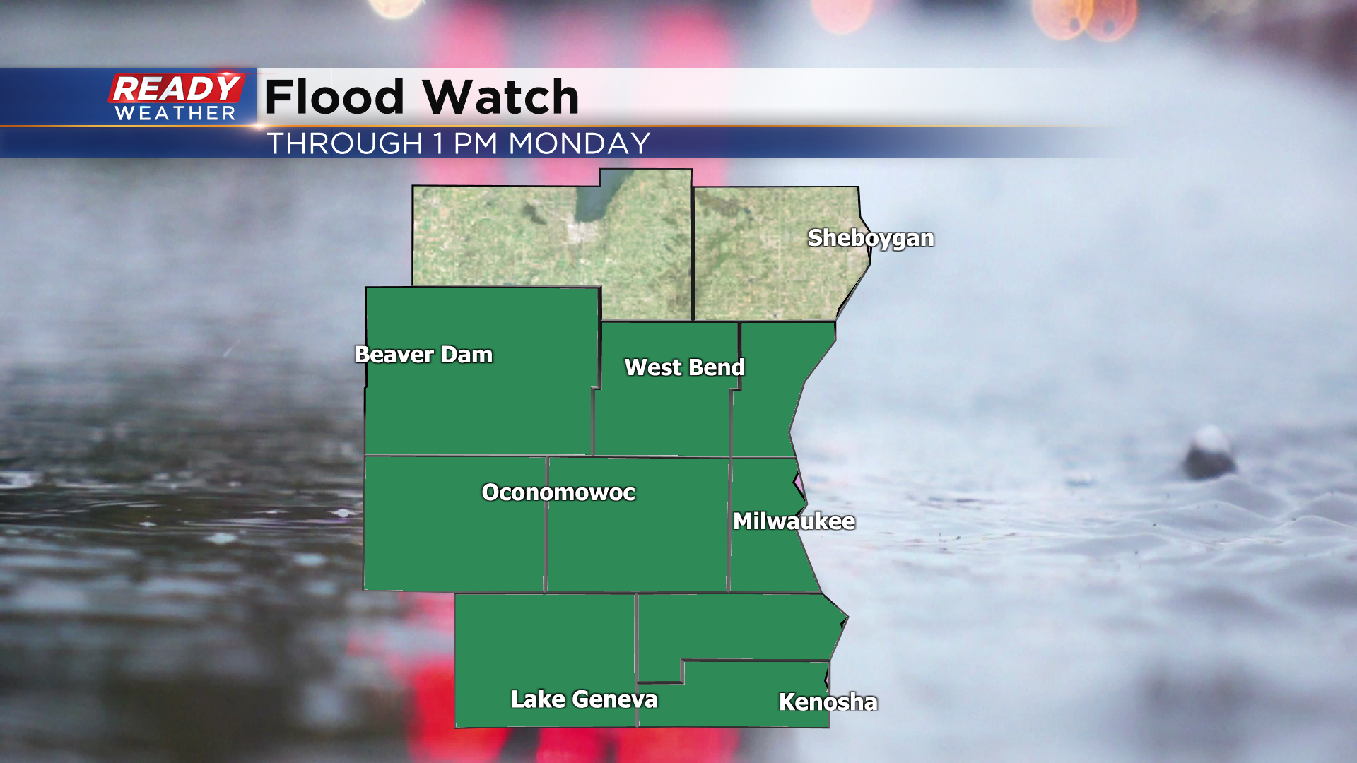
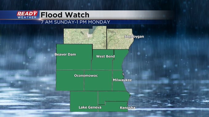
This may lead to areas of flooding and ponding on roadways. Please be careful if traveling this evening. A Flood Watch continues through 1pm Monday.
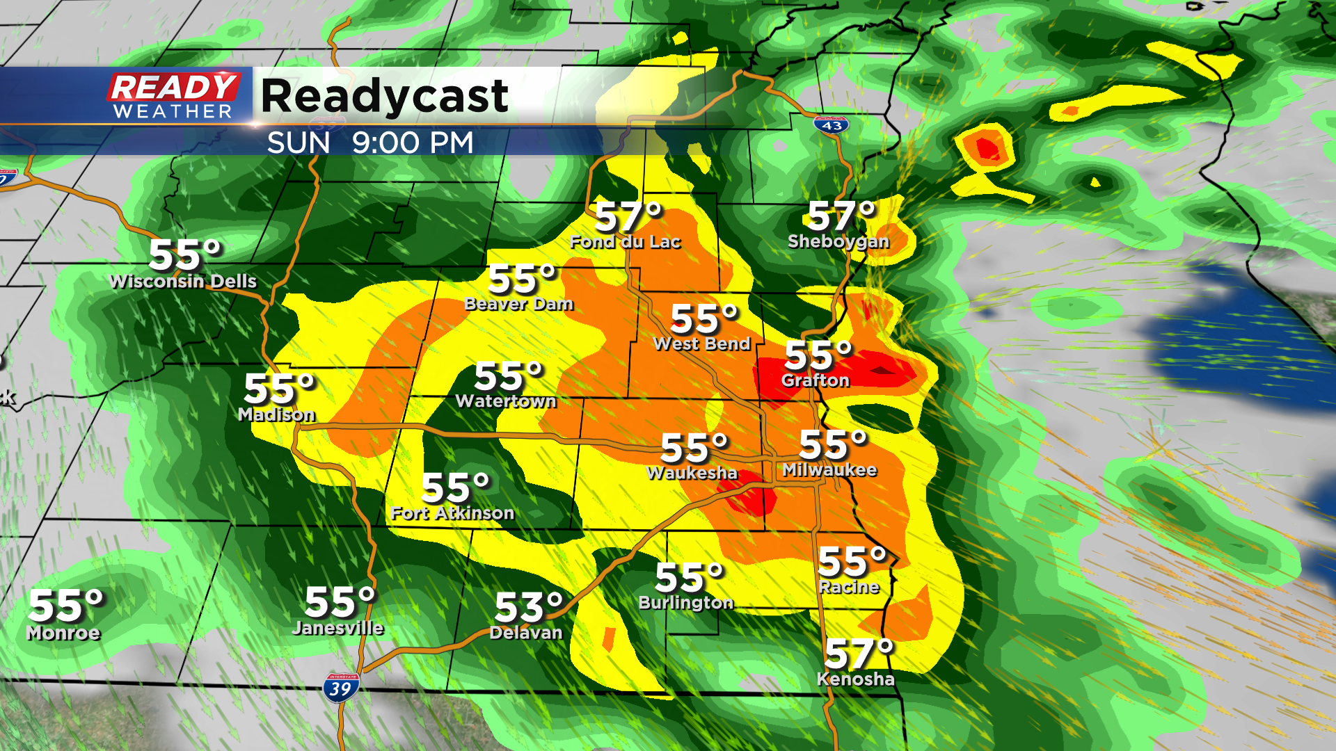
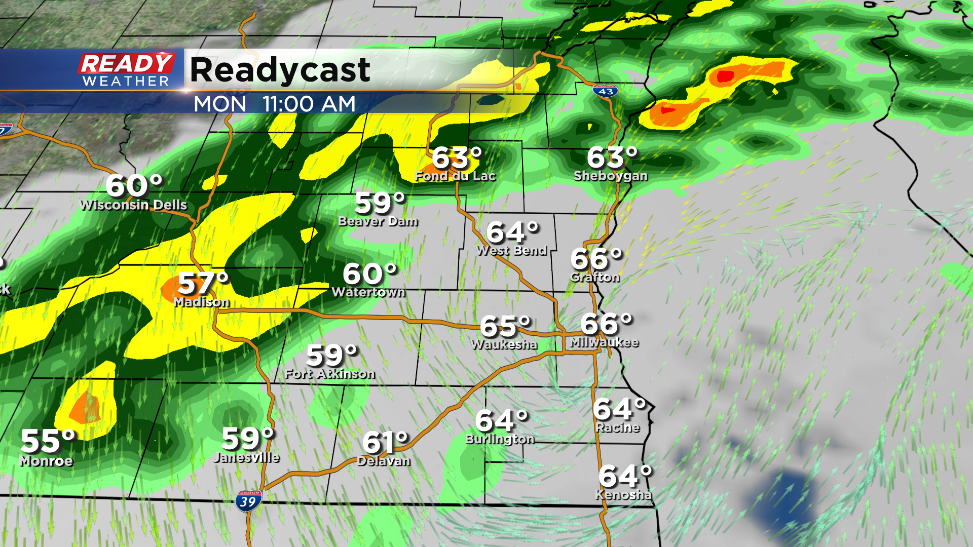
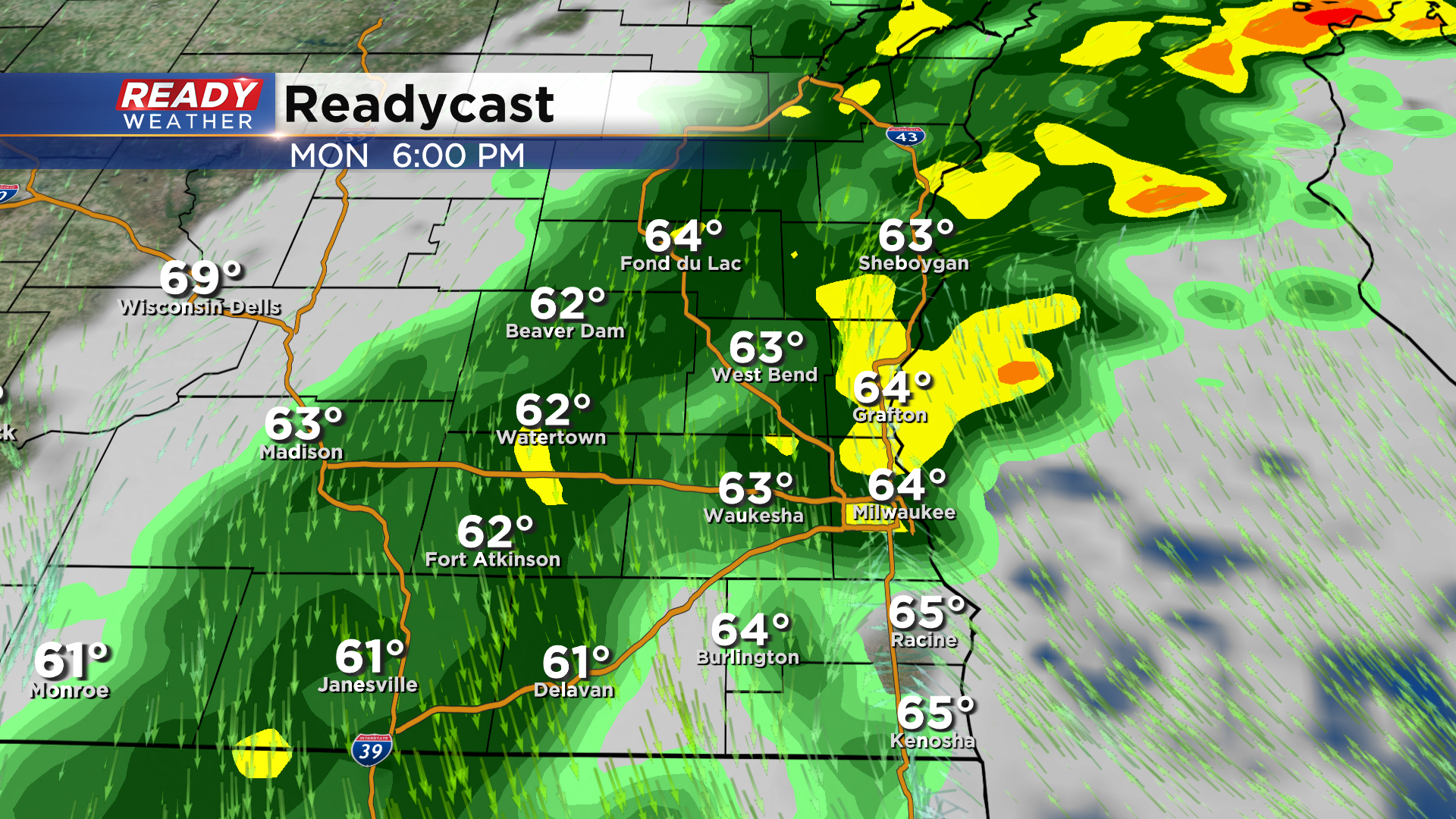
Rain will taper off to spotty showers after midnight with a break in the action for many on Monday morning, but showers will fill back in Monday afternoon and evening as the low pressure system finally pushes east.
----------------------------------------------------------------------------------------------------------------
Updated as of 8:45 am Sunday, September 11th...
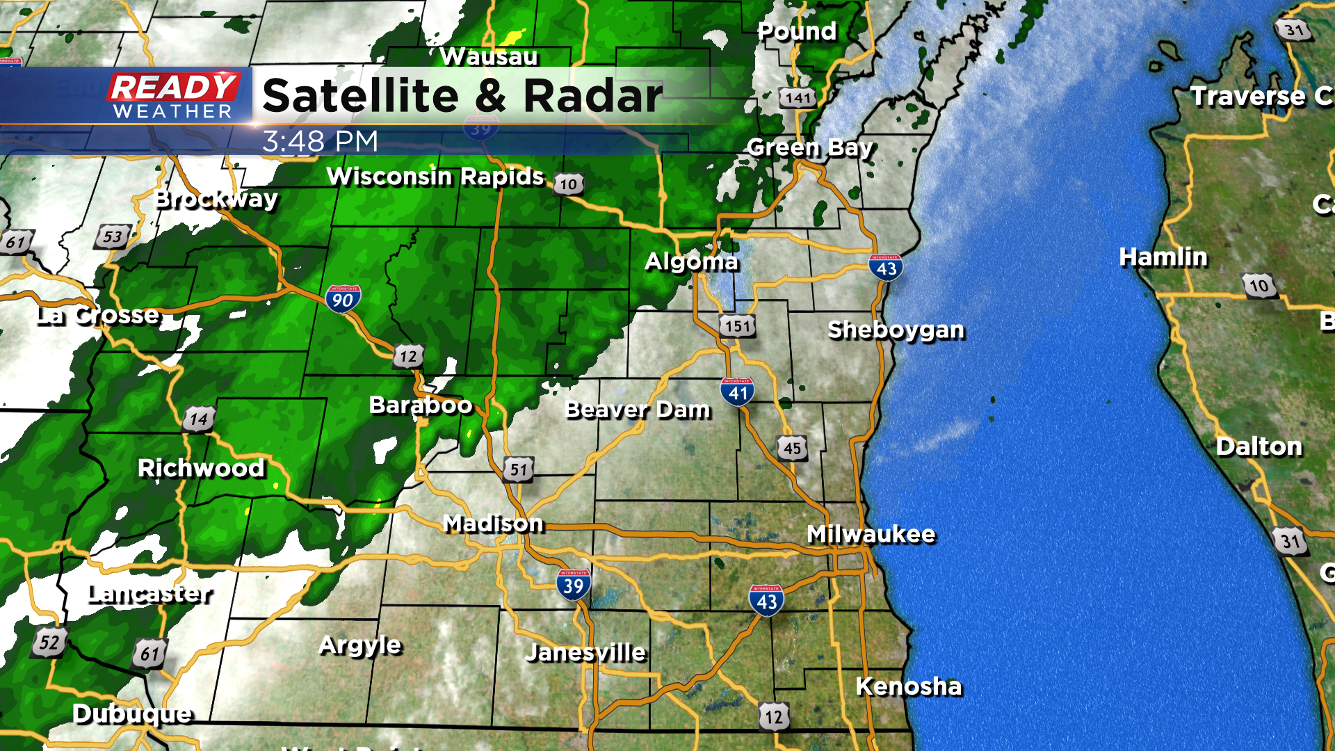
And we're off. the rain as overspread much of the area except for Fond du Lac and Sheboygan Counties (they're not in the Flood Watch.) Some areas near Mukwonago have already received two inches of rain. And this is just the start. 1-3"+ not out of the question if not more. It'll start to get better Tuesday mid-morning. But until then, expect low pressure to plague us.
_____________________________________________________________________________________________________________
Updated as of 6 am Sunday, September 11th...
A Flood Watch is in place for everyone except Fond du Lac and Sheboygan Counties. This goes until early afternoon on Monday. 3-5 inches of rainfall, generally speaking, can be expected. Watch for ponding on the roads and localized flooding in vulnerable spots. Please stay off Lake Michigan as well. High wind and waves expected.
___________________________________________________________________________________________________________
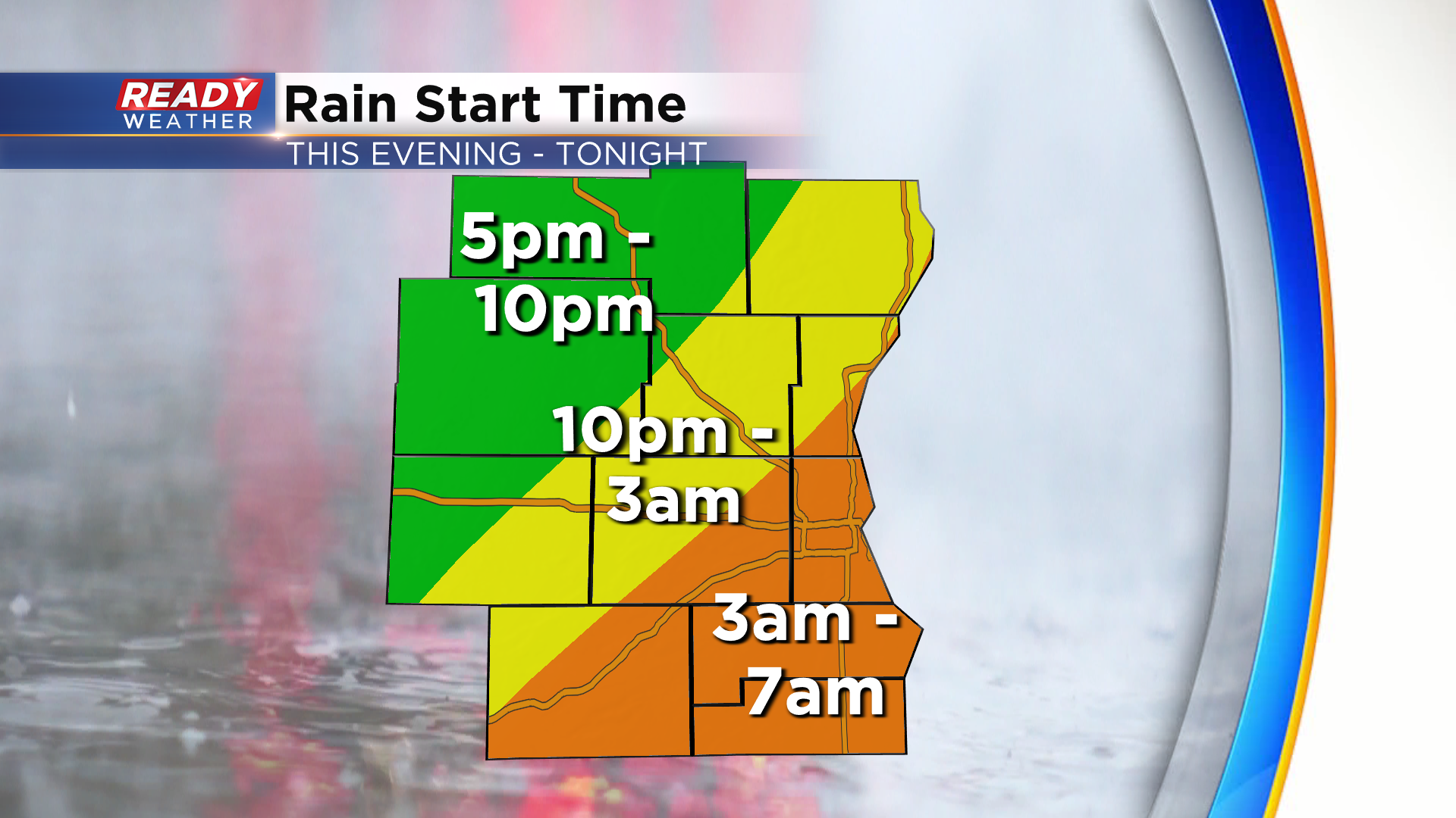
Hopefully you took advantage of today's dry weather and sunshine because we won't have either of those on Sunday. A large area of steady rain has been moving eastward very slowly throughout today behind a cold front.
That cold front has now stalled across SE WI and will help strengthen an area of low pressure that'll spin over southern Lake Michigan Sunday and Monday. The large area of rain will slowly overspread the area late this evening through sunrise Sunday morning.
Once the rain starts, it likely won't stop throughout the day. If you experience some dry time on Sunday, consider yourself lucky.
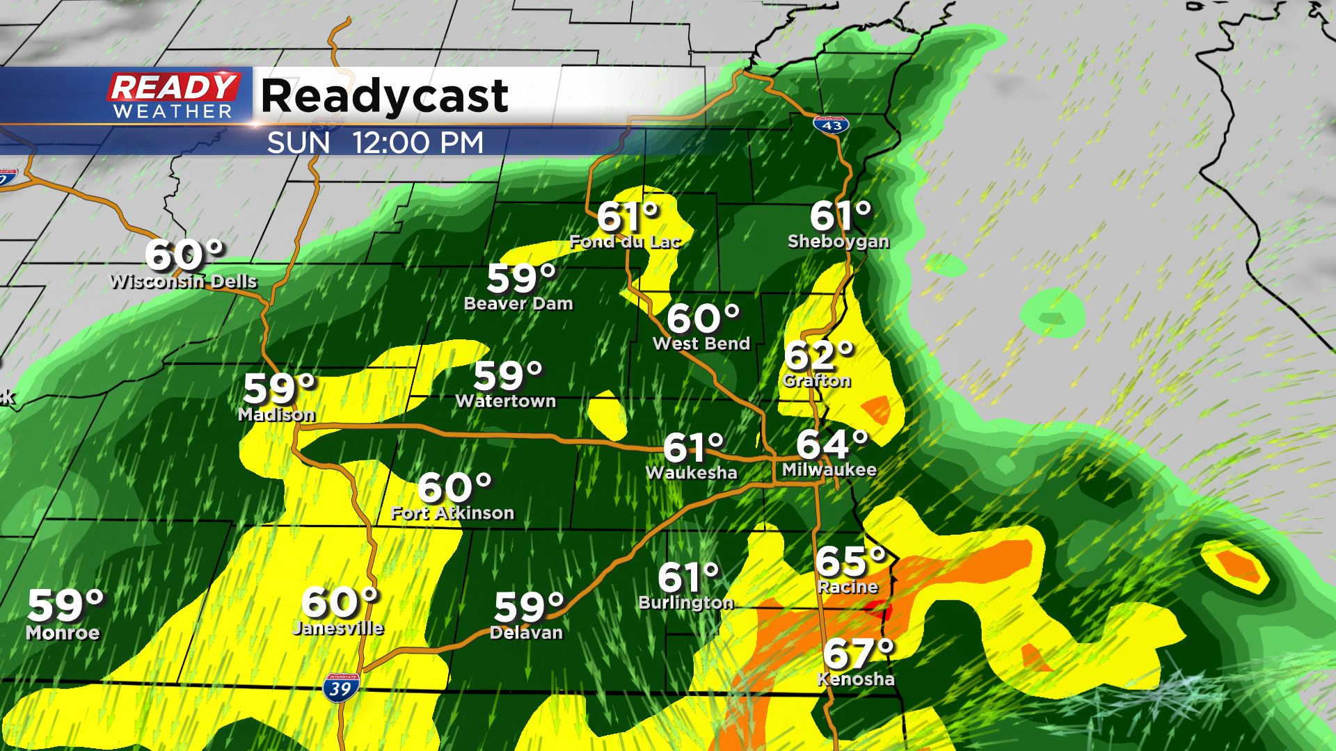
As the center of the low pressure system meanders closer to SE WI on Monday, we should have some dry time while the steadier rain lifts a bit more northwest. Best chance for dry time will be in Milwaukee, Racine, and Kenosha counties during the morning hours.
The low pressure system will begin to finally push east Monday afternoon, which will pull the showers back across all of southeast Wisconsin before ending Monday night.
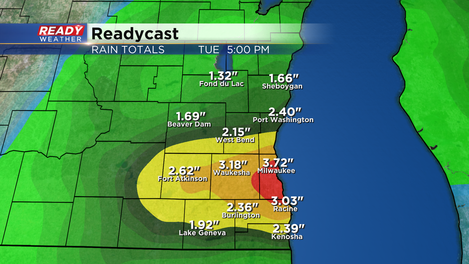
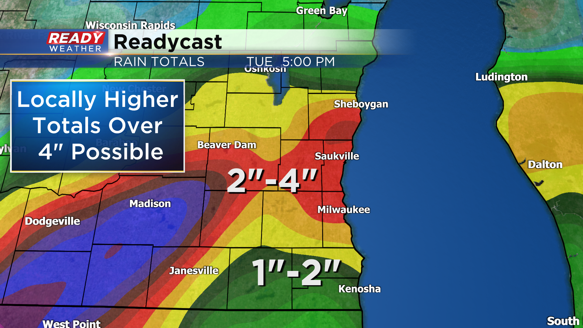
We're expecting quite a bit of rain with this system. A general 1 to 3 inches is expected across the entire area, but localized totals of 4 inches or more are definitely possible.
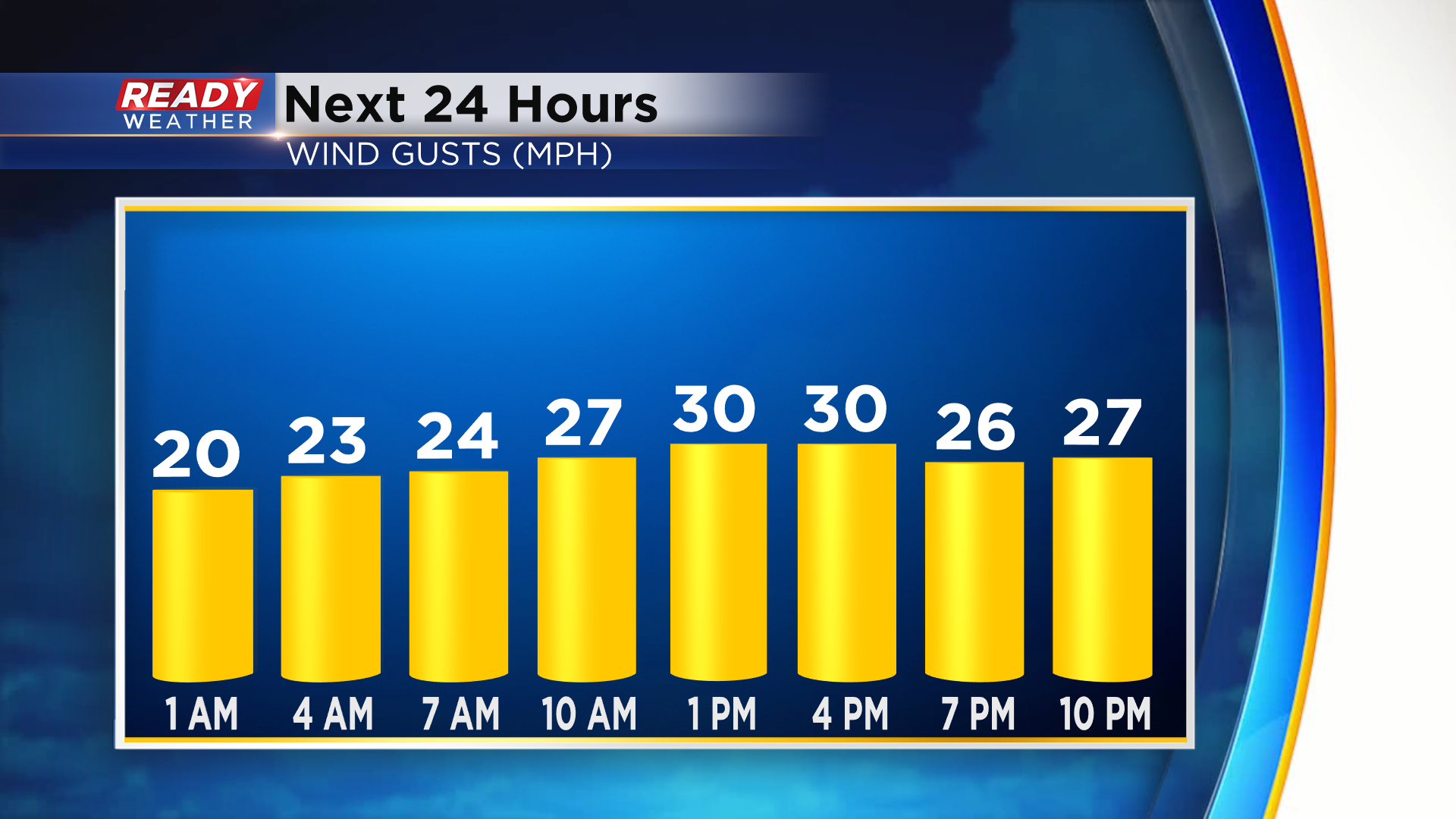
In addition to the steady rain, we'll also have to deal with gusty NNE winds of 25-35 mph on Sunday, making for a rather raw day with temps in the 50s and 60s.
Thankfully once the rain ends Monday night we'll be mainly dry through the rest of the week with temps warming back into the 70s and low 80s. Download the CBS 58 Ready Weather App to get any flood alerts sent to your phone.